Mirela together with colleagues at the University of North Carolina at Chapel Hill and State University of New York has received funding from NASA's Terrestrial Hydrology Program. The project will use multi-sensor integration to map flooding dynamics.
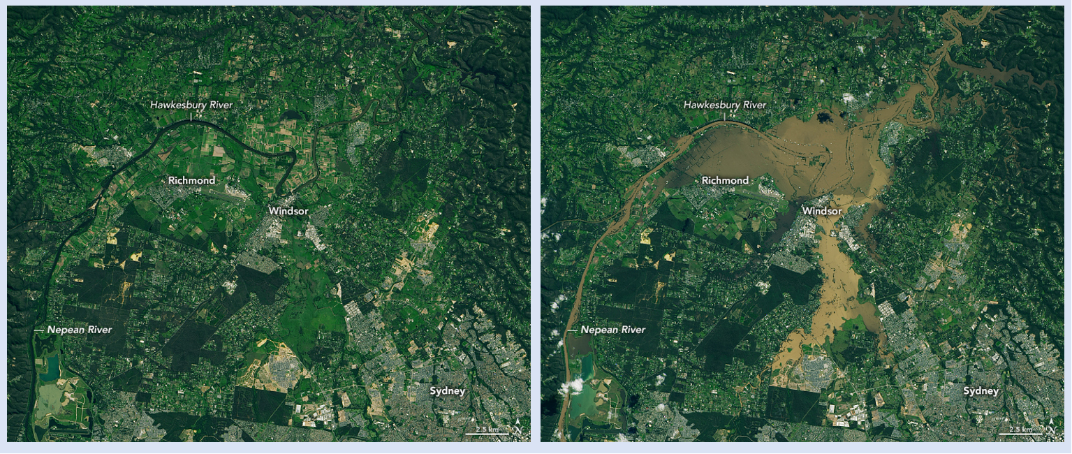
Before (left) and after (right) images showing the effect of persistent rain in March 2021 that led to historic flooding near Sydney, New South Wales, Australia. Both images were acquired by the Operational Land Imager (OLI) aboard the joint NASA/USGS Landsat-8 satellite and show the same region, with Sydney in the lower right corner. Left image: April 5, 2020. Right image: March 23, 2021. Images: NASA Earth Observatory.
News date:
March 2021