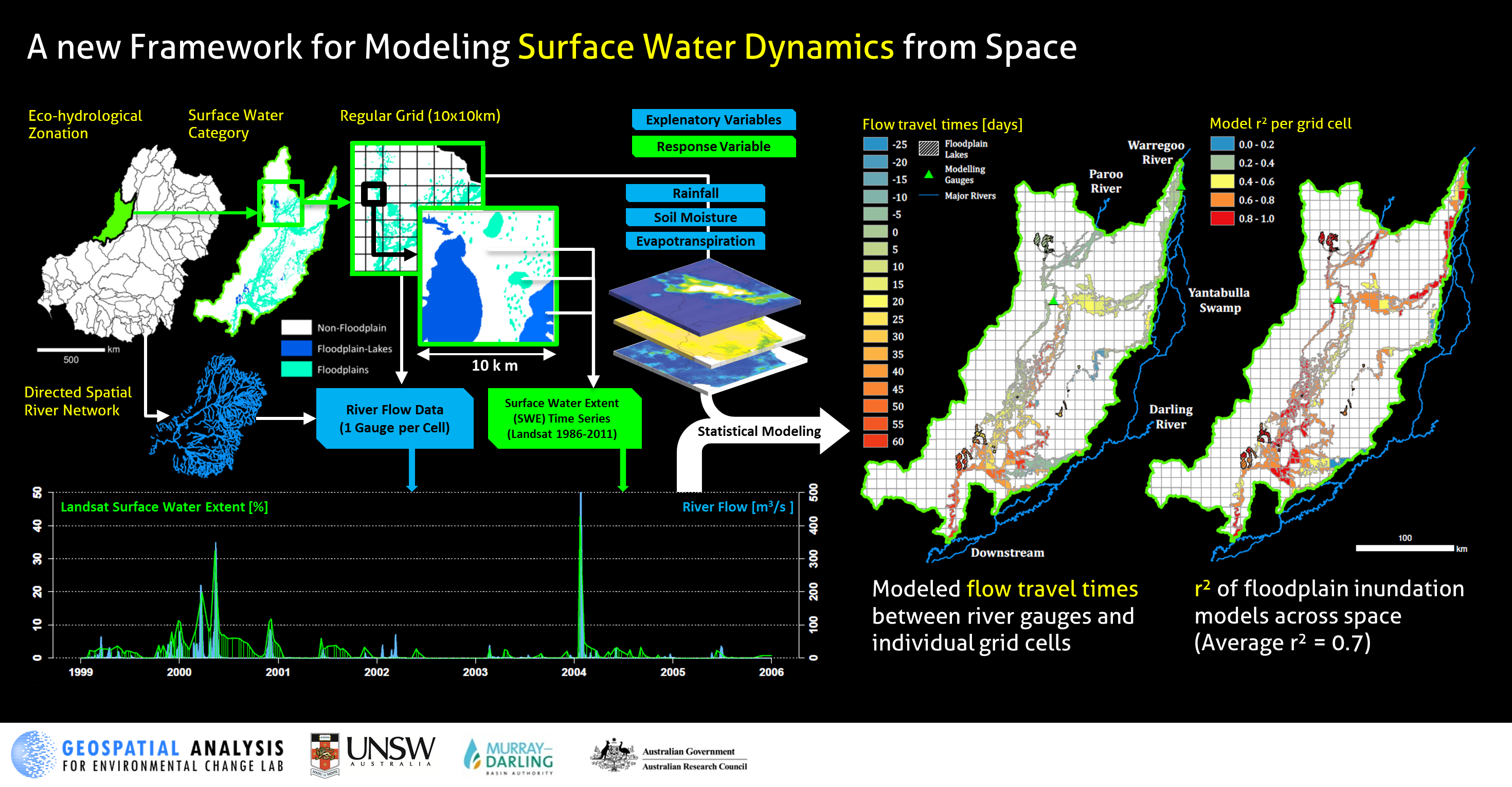
We used a unique Landsat-based time series of surface water extent (1986–2011), to statistically model surface water and inundation dynamics (SWD) as a function of river flow and spatially explicit time series of soil moisture, evapotranspiration and rainfall.
We developed an innovative spatial modeling framework, which allows modeling SWD separately for hydrologically distinct floodplain, floodplain-lake and non-floodplain areas within eco hydrological zones and 10 x 10 km grid cells.
We applied the spatial modeling framework to three hydrologically distinct sub-regions (Lower-Murray, Murrimbidgee, Paroo) of Australia’s Murray-Darling Basin (MDB)
We used dynamic linear regression as part of the spatial modeling framework to model SWD through periods of flooding and drying on 233 (64%) out of a total of 363 floodplain units within the three sub-regions with average r2 ≥ 0.6.
The contribution of rainfall, evapotranspiration and soil moisture to the model predictive performance differed among the three sub-regions, with the highest contribution in the least regulated and most arid sub-region (Paroo, see Figure below).
Our study provides a highly-automated and data-driven approach for modeling SWD that can be applied to other large river basins across the world, and represents a novel contribution, complementary to complex physically-based hydrodynamic models.
We are currently applying this framework to model surface water dynamics across the entire MDB, also incorporating MODIS data to improve the ability to capture rapid changes in SWD associated with flooding events
Heimhuber, V., M.G. Tulbure and M. Broich. 2016. Modeling 25 years of spatio-temporal surface water and inundation dynamics on large river basin scale using time series of Earth observation data. Hydrology and Earth System Sciences. 20: 2227-2250. [Download]