Tino's 3rd PhD manuscript, titled "Addressing spatio-temporal resolution constraints in Landsat and MODIS-based mapping of large-scale floodplain inundation dynamics" is out in Remote Sensing of Environment.
Article Reference
Heimhuber, V., Tulbure, M.G., Broich, M. (2018) Addressing spatio-temporal resolution constraints in Landsat and MODIS-based mapping of large-scale floodplain inundation dynamics. Remote Sensing of Environment. Volume 211, 15 June 2018, Pages 307–320
Article Highlights
• Recent studies have developed novel long-term records of surface water (SW) maps at continental and global scales but due to the spatial and temporal resolution constraints of available satellite sensors, they are either of high spatial and low temporal resolution or vice versa.
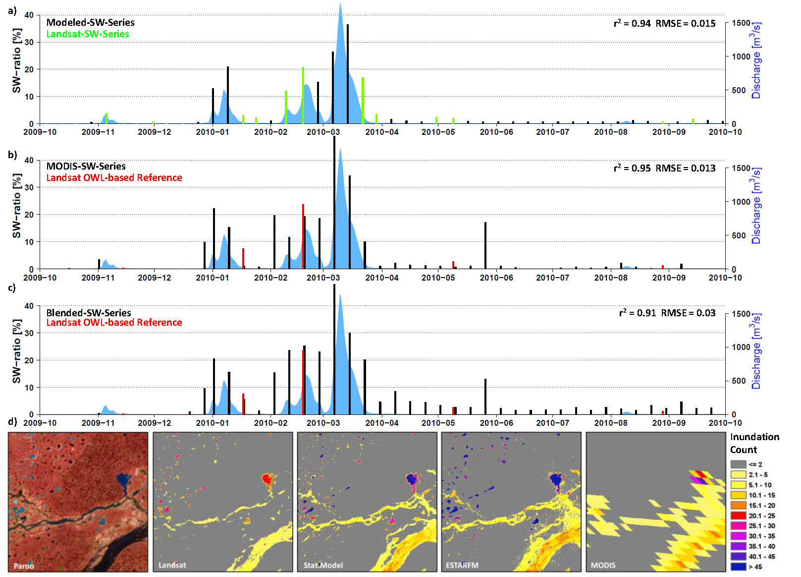
• We tested two approaches including a generalized additive regression model and image blending (STARFM and ESTARFM) for consistent 8-day 30 m inundation mapping
• ESTARFM and the statistical models were applied across three unique floodplain sites
• Both methods provided new and consistent information on flood dynamics.
• Our study provides a first 2-year long 8-daily mapping of 30 m floodplain inundation.
• These SW records hold great potential for assimilation into hydrodynamic and hydrological models as well as improved management of terrestrial freshwater ecosystems.
An animated abstract can be found here