Our latest work and Yuri's 3rd PhD paper "Multi-sensor airborne and satellite data for upscaling tree number information in a structurally complex forest", was published this week in the International Journal of Applied Earth Observation and Geoinfromation: http://www.sciencedirect.com/science/article/pii/S0303243418303155
Here are the highlights:
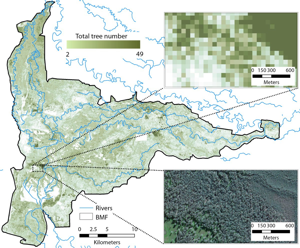
- We used ALS (LiDAR), WorldView 2 very-high resolution imagery, and SAR (radar) to upscale tree number information
- ALS dervied tree numbers were used for training a random forest regressor
- Tree numbers were upscaled with an R2 of 0.61 and RMSE of 62%
- ALS and WorldView-2 predictors were the best for estimating tree numbers
- The SAR predictors alone were unable to estimate tree numbers reliably
Citation: I. Shendryk, M. Broich, M.G. Tulbure (2018). Multi-sensor airborne and satellite data for upscaling tree number information in a structurally complex eucalypt forest. International Journal of Applied Earth Observation and Geoinformation (73): 397-406.
News date:
July 2018